Skip to content
Search
Log in
Sign up
Cart (
0
)
Menu
About
Celestial Maps and Charts
Country Maps
Folding Maps
Framed Maps
Historic Maps
Large Wall Maps
London Street Maps and Plans
Selected Atlas Maps and Plates
Space Art
Log in
Sign up
Facebook
Instagram
Home
1
›
Country Maps
2
Country Maps
Filter by
Filter by
Algeria
America
Arabia
Argentina
Asia
Asia Minor
Atlantic Ocean
Australasia
Australia
Austria
Barbary
Bartholomew
Benghazi
Burma
canada
Central America
Central USA
Chile
Collins
County Map
County Maps
early 20th century
eastern USA
Europe
France
Further India
George Philip
Honshiu
Hungary
Japan
Johnston
Kiushiu
late 19th Century
Late19th century
Map of India
Maritime provinces
Mexico
Mid20th century
Mongolia
Morocco
mounted map
New Brunswick
New South Wales
Newfoundland
Nile
North Africa
North America
Nova Scotia
Oceania
Oceans
Ontario
Original
Pacific
Pacific Ocean
Paraguay
Persian Gulf
Physical
Portugal
Queensland
Red Sea
Russia
Sahara
Shikoku
Siberia
South America
South Australia
South East England
Southern South America
Southern States
Spain
Tunisia
Turkey
United States
Uruguay
USA
Victoria
Wales
Western Canada
Western USA
Yakutsk
Sort by
Featured
Most relevant
Best selling
Alphabetically, A-Z
Alphabetically, Z-A
Price, low to high
Price, high to low
Date, old to new
Date, new to old
Maps of Countries.
Mounted and unmounted.
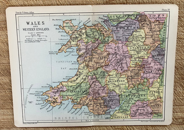
Map of Wales
Regular price
£10.00
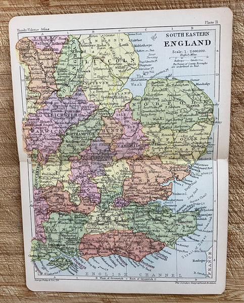
Map of South East England
Regular price
£10.00
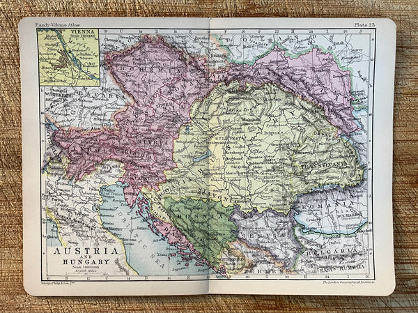
Map of Austria & Hungary
Regular price
£10.00
Map of France
Regular price
£10.00
Map of Spain & Portugal
Regular price
£10.00
Map of Russia
Regular price
£10.00
Map of Asia
Regular price
£10.00
Map of Turkey in Asia
Regular price
£10.00
Map of North Africa
Regular price
£10.00
Map of North America
Regular price
£10.00
Map of the Dominion of Canada
Regular price
£10.00
Map of The Maritime Provinces of Canada
Regular price
£10.00
1
2
3
4
Next »
Choosing a selection results in a full page refresh.
Press the space key then arrow keys to make a selection.