Skip to content
Search
Log in
Sign up
Cart (
0
)
Menu
About
Celestial Maps and Charts
Country Maps
Folding Maps
Framed Maps
Historic Maps
Large Wall Maps
London Street Maps and Plans
Selected Atlas Maps and Plates
Space Art
Log in
Sign up
Facebook
Instagram
Home
1
›
Large Wall Maps
2
Large Wall Maps
Filter by
Filter by
Abercrombie
Airports
Ashley Green
Australia
Bacons
Bermondsey
Buckinghamshire
Bucks
Camberwell
Central London
Chesham
Framed Map
framed maps
Geology
Greater London Plan
Kennington
Lambeth
Latimer
London
mid 20th Century
Ordnance Survey
Original
Oval
Planning Map
Planning maps
Railways
South East London
Southwark
Street Plan
Transport
Unmounted
Sort by
Featured
Most relevant
Best selling
Alphabetically, A-Z
Alphabetically, Z-A
Price, low to high
Price, high to low
Date, old to new
Date, new to old
Original large schoolroom maps and posters.
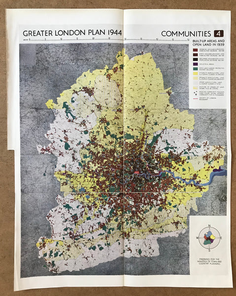
Greater London Plan 1944 : Communities 4
Regular price
£30.00
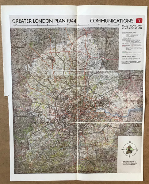
Greater London Plan 1944 : Communications 7
Regular price
£30.00
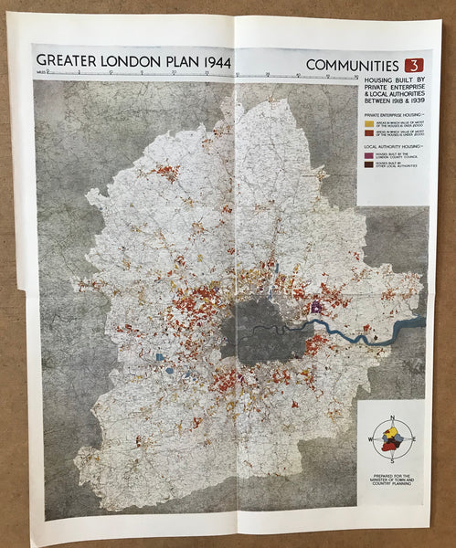
Greater London Plan 1944 : Communities 3
Regular price
£30.00
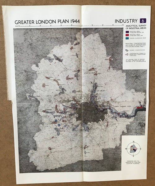
Greater London Plan 1944 : Industry 6
Regular price
£30.00
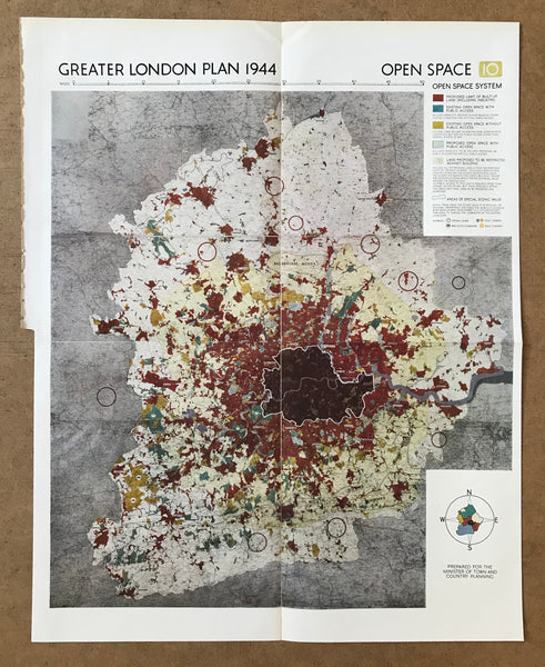
Greater London Plan 1944 : Open Space 10
Regular price
£30.00
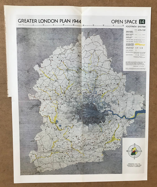
Greater London Plan 1944 : Open Space 14
Regular price
£30.00
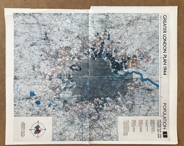
Greater London Plan 1944 : Population
Regular price
£30.00
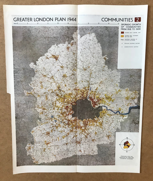
Greater London Plan 1944 : Communities 2
Regular price
£30.00
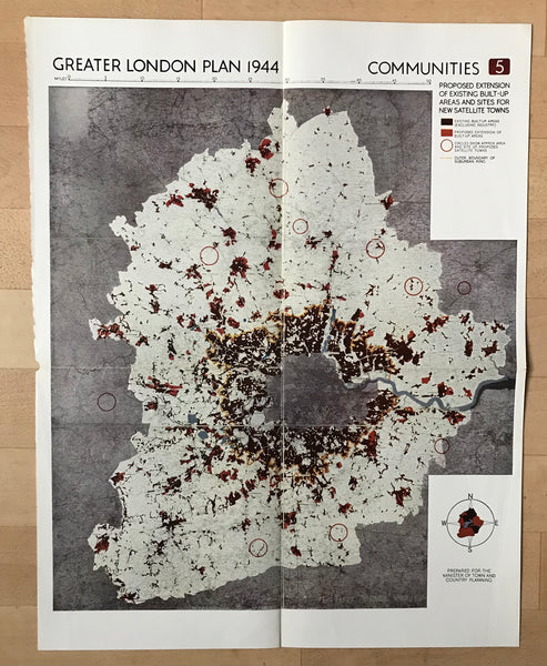
Greater London Plan 1944: Communities 5.
Regular price
£30.00
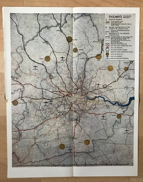
Greater London Plan 1944: Railways
Regular price
£30.00
—
Sold Out
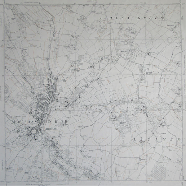
Large Unframed 1960 Ordnance Survey map of Chesham and Environs
Regular price
£40.00
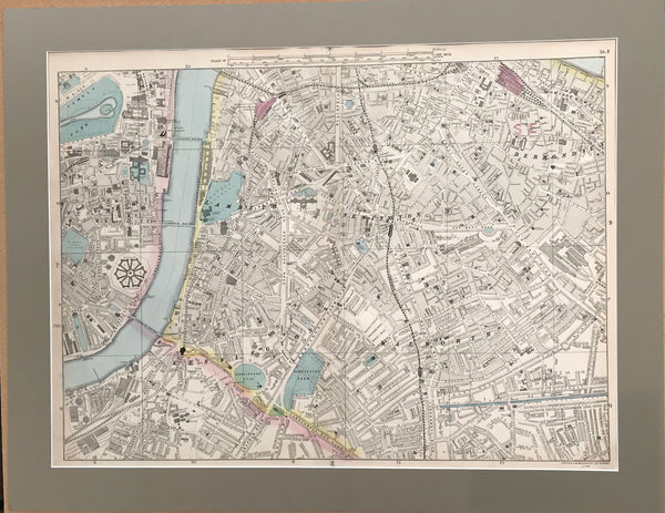
Large Mounted 1880 Street Plan of Southwark by Bacon.
Regular price
£245.00
1
2
Next »
Choosing a selection results in a full page refresh.
Press the space key then arrow keys to make a selection.