Skip to content
Search
Log in
Sign up
Cart (
0
)
Menu
About
Celestial Maps and Charts
Country Maps
Folding Maps
Framed Maps
Historic Maps
Large Wall Maps
London Street Maps and Plans
Selected Atlas Maps and Plates
Space Art
Log in
Sign up
Facebook
Instagram
Home
1
›
Products
2
Products
Filter by
Filter by
17th Century
1860
18th Century
1950's
Abercrombie
Airports
Algeria
America
antique map
Arabia
Argentina
Ashley Green
Asia
Asia Minor
Astronomy
Atlantic Ocean
Australasia
Australia
Austria
Bacons
Barbary
Barking
Bartholomew
Bedfordshire
Benghazi
Bermondsey
Buckinghamshire
Bucks
Burma
Camberwell
canada
celestial
Celestial Maps
Central America
Central London
Central USA
Charlton
Chesham
Chile
Colindale
Collins
Copthall
Cornwall
County Map
County Maps
Creighton
Dagenham
Devon
early 20th century
Earth
East Ham
East London
eastern USA
Europe
Framed Map
framed maps
France
Further India
Geology
George Philip
Greater London Plan
Heavens
Hendon
Honshiu
Hungary
Ilford
Japan
Johnston
Kennington
Kiushiu
Lambeth
late 19th Century
Late19th century
Latimer
London
Lunar
Map of India
Maps of London
Maritime provinces
Mars
Mexico
Mid 19th century
mid 20th Century
mid19thcentury
Mid20th century
Milky Way
Mongolia
Moon
Morocco
mounted
mounted map
New Brunswick
New Cross
New South Wales
Newfoundland
Nile
Norfolk
North Africa
North America
Nova Scotia
Oceania
Oceans
Old Kent Road
Ontario
Ordnance Survey
original
Oval
Pacific
Pacific Ocean
Paraguay
Persian Gulf
Physical
Plaistow
Planets
Planning Map
Planning maps
Portugal
proctor
Queensland
RA Smith
Railways
Red Sea
Richard Creighton
Russia
Sahara
Satellite
Seasons
Shikoku
Shooters Hill
Siberia
South America
South Australia
South East England
South East London
South West England
Southern South America
Southern States
Southwark
Space
Space Art
Space Man
Space Station
Spain
stars
Street Plan
Street Plans
Sun
Transport
Tunisia
Turkey
United States
Unmounted
Uruguay
USA
Victoria
Wales
Weightless
Western Canada
Western USA
Woolwich
Yakutsk
Sort by
Featured
Most relevant
Best selling
Alphabetically, A-Z
Alphabetically, Z-A
Price, low to high
Price, high to low
Date, old to new
Date, new to old
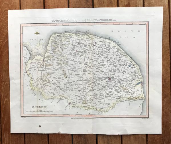
1845 Original Hand Coloured map of Norfolk by Creighton.
Regular price
£40.00
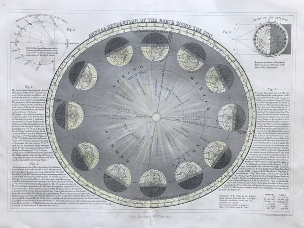
1860 Annual Revolution of the Earth round the Sun
Regular price
£90.00
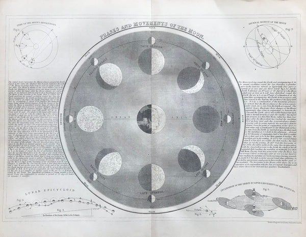
1860 Phases and Movements of the Moon
Regular price
£90.00
1872 The Celestial Sphere
Regular price
£80.00
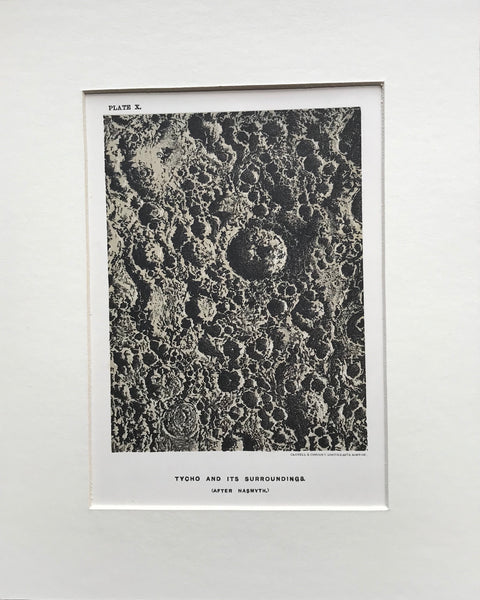
1878 Lunar Landscape
Regular price
£25.00
—
Sold Out
1880 Map of France by Collins.
Regular price
£15.00
1880 Map of Spain and Portugal by Collins.
Regular price
£15.00
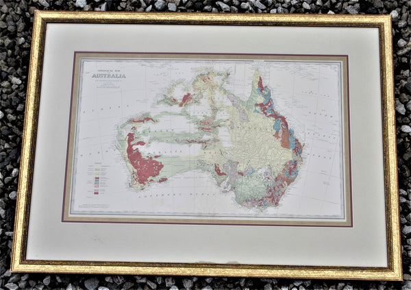
1888 Geological Map Of Australia
Regular price
£300.00
1890 Map of Nova Scotia and Newfoundland
Regular price
£15.00
1890 Map of Ontario
Regular price
£15.00
1890 Map of Russia in Europe
Regular price
£15.00
1890 Map of South America
Regular price
£15.00
1
2
3
…
9
Next »
Choosing a selection results in a full page refresh.
Press the space key then arrow keys to make a selection.